 By
By 
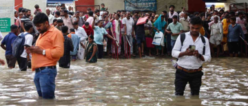
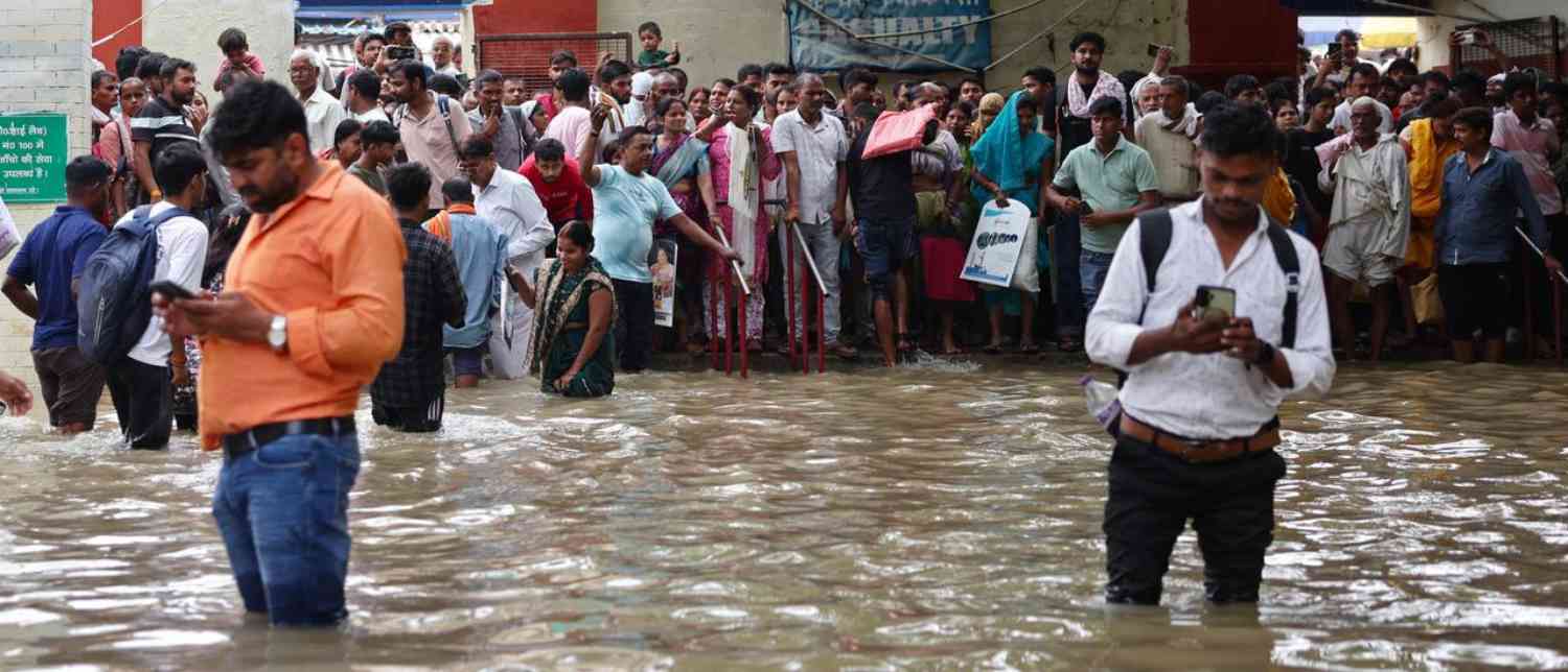
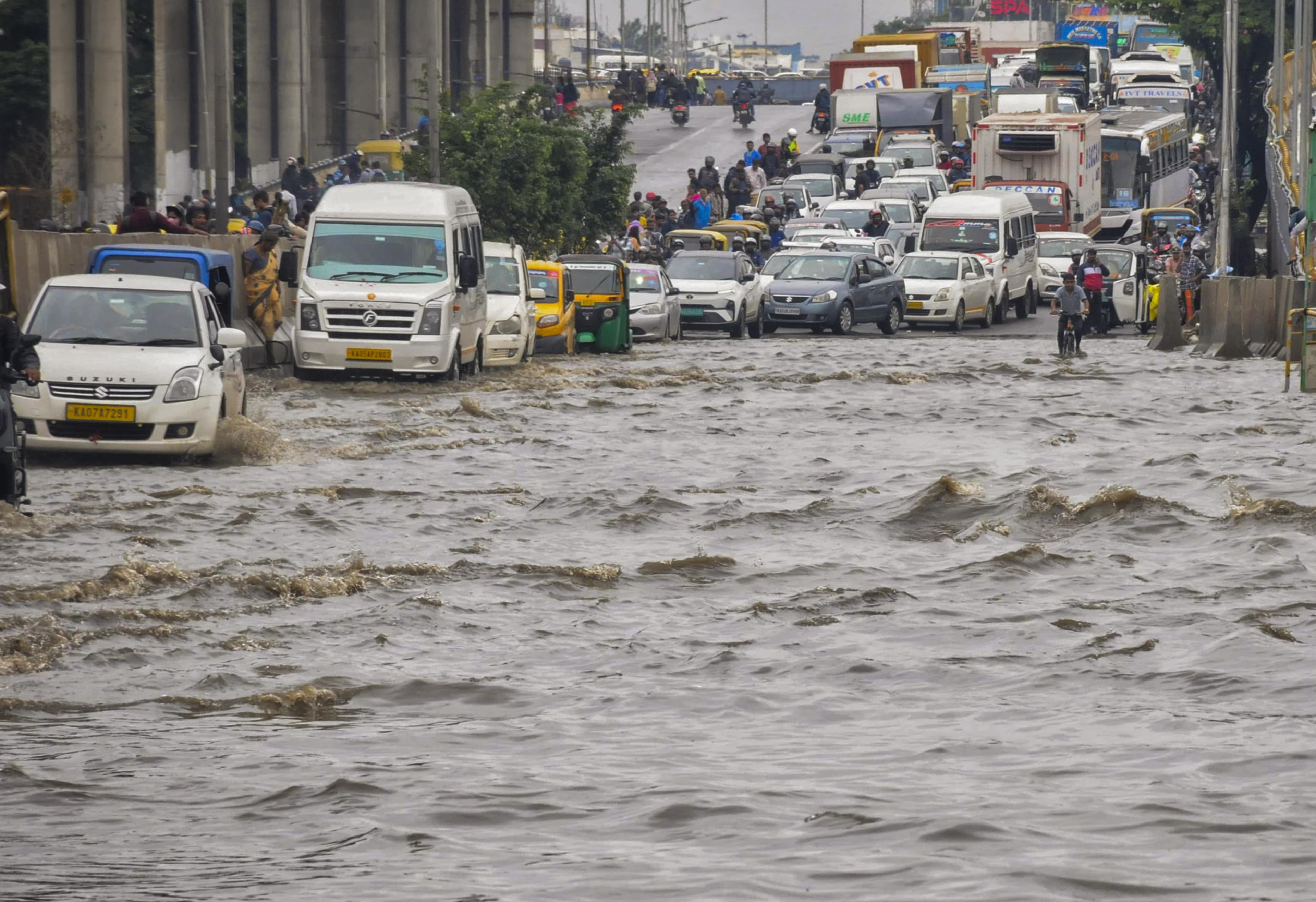
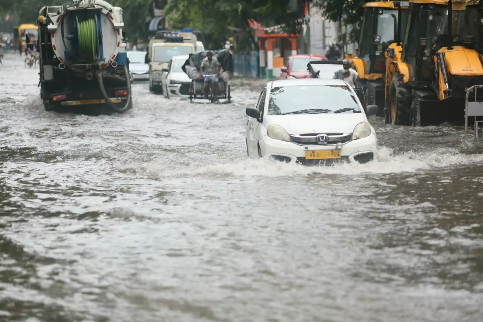
Every monsoon, Indian cities seem to rediscover the same uncomfortable truth: a city can have glass towers, expressways, luxury housing, corporate parks and billion-rupee infrastructure projects, yet still be brought to a standstill by a few hours of intense rain. The images are now almost routine—cars stranded on flooded roads, commuters wading through dirty water, school buses unable to move, underpasses shut, traffic crawling for kilometres and residents asking the same question: why does a modern city become so helpless when it rains?
The recent flooding in Gurugram provides perhaps the clearest illustration. On August 24, the city received around 75 mm of rain between 8 am and 5 pm. Major roads including Sohna Road, Golf Course Road, MG Road, the Delhi-Gurgaon Expressway, Rajiv Chowk, IFFCO Chowk and Udyog Vihar were severely affected. Traffic came to a standstill, while schoolchildren remained trapped in buses for hours. In one case, a child who left school at 12:30 pm reportedly reached home only at 8:30 pm. The following day, authorities advised schools and offices to shift online or work from home.
The obvious explanation is heavy rainfall. But it is also the easiest explanation, because it allows us to treat every flood as an act of nature rather than asking whether the city itself has helped create the disaster.
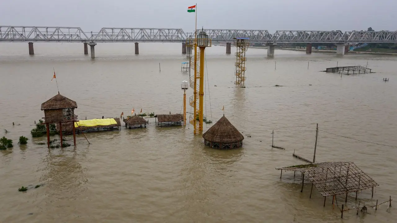
The harder truth is that urban flooding is rarely caused by rain alone. A flood becomes an urban disaster when intense rainfall meets a landscape that can no longer absorb water, drainage systems that cannot carry the resulting runoff, natural water bodies that have been lost or encroached upon, and institutions that repeatedly respond after the crisis rather than reducing vulnerability before it occurs. Across Indian cities, climate change is intensifying the rainfall hazard, but decades of urbanisation and weak planning are determining how destructive that hazard becomes.
The rain is changing, but the city is changing too
There is no reason to dismiss climate change as a factor in India’s worsening urban flood problem. A warmer atmosphere can hold more moisture, increasing the potential for intense rainfall. Research has found a substantial increase in extreme rainfall events over central India, while meteorological observations increasingly point to short-duration, high-intensity downpours as an important driver of urban flooding. In Mumbai, for instance, the contrast between the traditional image of long, steady monsoon rain and today's increasingly intense bursts is becoming difficult to ignore.
The physics is straightforward. For every 1°C of warming, air can hold roughly 7% more water vapour. When that moisture is released, the rainfall can arrive in concentrated bursts rather than being distributed evenly over a longer period. India's cities are therefore facing a difficult combination: more intense rainfall events and urban landscapes that are increasingly incapable of absorbing them.
Yet climate change should not become a convenient excuse for every flooded road. The same rain does not produce the same disaster everywhere. What turns weather into a crisis is exposure and vulnerability, and those are heavily influenced by human decisions.
Consider what happens when an open field becomes a parking lot. When rain falls on soil, some water infiltrates the ground. When it falls on concrete, asphalt or a paved parking area, much more of it becomes surface runoff. Multiply that transformation across an entire city and the volume of water reaching storm drains can increase dramatically. If those drains are undersized, blocked, poorly connected or poorly maintained, flooding is almost inevitable once rainfall exceeds their capacity.
This is the fundamental contradiction at the heart of India's urban development: cities are becoming more built-up at precisely the time when they need more space for water.
Gurugram did not always have a water problem
Gurugram's transformation is particularly instructive because its current identity is almost the opposite of its historical landscape. In the 1960s, Gurgaon was a much smaller settlement surrounded by agricultural land and villages. Fields, ponds, soil and natural drainage channels gave rainwater room to infiltrate and move.
The arrival of Maruti in 1981 accelerated industrialisation, and the development boom of the 1990s transformed agricultural land into residential colonies, commercial developments and roads. The growth of the information technology and services economy accelerated that transformation further, turning Gurgaon into one of India's most important corporate centres. Between 1989 and 2012, the city's urbanisable area expanded from approximately 9,900 acres to more than 27,000 acres.
Economic growth was not the problem in itself. Cities have to expand when populations and economies grow. The problem was that the physical systems that once managed water did not receive equivalent importance in the new urban model.
Gurugram's natural storage capacity has been dramatically reduced. An assessment submitted to the National Green Tribunal found that the city lost 389 water bodies over 66 years, leaving 251 from the 640 recorded in 1956. At the same time, natural drainage channels have been altered, narrowed or blocked, while roads, buildings and parking areas have created increasingly impermeable surfaces.
The result is not complicated. Rainwater arrives faster than the city can absorb or move it.
Gurugram's geography makes the problem even more acute. The city sits in a natural basin, and stormwater from the surrounding Aravalli hills can rush towards the urban plains. A large volume of this runoff enters the Badshahpur drain, which can be overwhelmed during heavy rainfall, contributing to flooding on major roads and residential areas.
This means Gurugram's flooding cannot be solved simply by asking whether the city has enough drains. The more important question is whether the entire drainage landscape—from the hills and natural channels to local stormwater drains and downstream systems—has been planned as one interconnected system.
A ₹503-crore question
This brings us to the uncomfortable issue of public money.
Gurugram's administration spent close to ₹503 crore over nine years, up to 2025, on improving drainage infrastructure. Yet another spell of heavy rain was enough to bring large parts of the city to a standstill. The civic body had reported desilting its three major master drains and completing work at 158 vulnerable waterlogging locations by June, but flooding returned to several major corridors. Even a road redeveloped at a cost of ₹11.8 crore continued to experience waterlogging.
The question, therefore, is no longer simply whether the government is spending money. It is whether the money is producing resilience.
There is a crucial difference between infrastructure expenditure and infrastructure effectiveness. A city can spend hundreds of crores on drains, pumps, road repairs and desilting and still remain vulnerable if the underlying system is flawed. Repeated pumping after a road has already flooded is emergency response, not flood prevention. Repairing potholes after every monsoon is maintenance, but it is not a substitute for designing roads that can withstand the conditions they routinely face.
Gurugram's annual cycle demonstrates the problem. The monsoon arrives, roads flood, drains clog, traffic collapses, pumps are deployed, temporary repairs begin and residents are assured that the issue is being addressed. Then the cycle repeats the following year. As of late July, only 177 km of a 396-km road-repair target for 2026 had been completed, leaving more than 219 km still pending. At the same time, only 209 of the municipal corporation's 427 sanctioned posts were filled, leaving 218 vacancies.
That staffing gap matters more than it might appear. Drainage systems do not maintain themselves. Roads need inspection. Encroachments need monitoring. Waste needs to be removed. Waterlogging hotspots need permanent engineering solutions. Drain capacity needs to be assessed. None of this can be accomplished through emergency teams appearing after the water has already entered people's homes and vehicles.
A resilient city requires year-round administrative capacity.
The same failure appears across India
Gurugram may be today's most visible example, but the underlying pattern is national.
Bengaluru provides a striking illustration of what rapid concretisation can do. Research cited in recent assessments found that built-up land in the city increased from roughly 8% in 1973 to nearly 74% in 2013, while vegetation declined from about 68% to less than 15%. The transformation has enormous implications for both flooding and heat. As natural surfaces disappear, rainwater has fewer opportunities to infiltrate the ground, while the replacement of vegetation with hard surfaces increases heat retention.
Mumbai presents a different geographical case but an almost identical planning lesson. The city historically depended on a network of wetlands, mangroves, salt pans, lakes, rivers and creeks to absorb and move water. Between the early 1990s and 2005, Mumbai and Thane reportedly lost around 40% of their wetlands. The Mithi River, one of Mumbai's key drainage channels, was narrowed through encroachment and construction, reducing its ability to carry stormwater.
The 26 July 2005 flood remains the benchmark. Mumbai received 944 mm of rain in 24 hours, an extraordinary event that exposed the vulnerability created when extreme rainfall encounters a city whose natural drainage capacity has been progressively reduced. But the lesson from 2005 should not simply be that an unusually large amount of rain can flood Mumbai. The more important lesson is that natural systems matter, and once they are destroyed, replacing them with concrete infrastructure is neither easy nor necessarily sufficient.
Mumbai's own climate planning acknowledges the scale of the challenge: even with drainage upgraded to handle 50 mm of rainfall per hour, parts of the city could still flood if an event comparable to 2005 occurs.
That should fundamentally change the way cities think about drainage.
The objective cannot simply be to move water away faster.
Cities must also learn to hold, absorb and slow water down.
Flooding and heat are two sides of the same urban failure
Perhaps the most important insight emerging from India's recent climate experience is that flooding and extreme heat should not be treated as separate problems.
Gurugram's weather this year makes the point vividly. Parts of the city crossed 44°C during the May heatwave period. Roughly eleven weeks later, the same city was struggling with severe waterlogging. The two events looked completely different, but they were intensified by many of the same urban conditions: dense construction, loss of open land and vegetation, inadequate public systems and development that has not kept pace with climate risk.
The urban heat-island effect is one consequence. The World Bank estimates that temperatures in Indian city centres can be 3–4°C higher than surrounding areas. Hard surfaces absorb and retain heat, while fewer trees and open spaces reduce shade and natural cooling. Poorly ventilated housing and outdoor work without access to shade, drinking water or healthcare further increase vulnerability.
The same loss of vegetation and open soil also worsens flooding because there is less land through which rainwater can infiltrate.
This is why urban climate policy cannot be divided neatly into “flood policy” and “heat policy”. A tree can provide shade and help absorb rainfall. A restored lake can moderate local temperatures while storing stormwater. A permeable public space can reduce runoff and heat simultaneously.
The best climate infrastructure can therefore solve more than one problem at a time.
The deeper problem is planning
If Indian cities know which roads flood every year, why do those roads continue to flood?
Part of the answer lies in the country's planning deficit. Around 65% of India's 7,933 urban settlements reportedly lacked a master plan, according to a NITI Aayog assessment cited in recent analysis. The shortage of professional town planners makes the situation worse: state planning departments have had fewer than 4,000 sanctioned town-planner posts against an estimated requirement of around 12,000.
Even where plans exist, implementation is often fragmented. Roads may be controlled by one agency, drainage by another, land-use decisions by another and emergency response by yet another. A road can therefore be built without adequately accounting for the drainage system around it; a development can be approved without considering the floodplain; and a drain can be upgraded without addressing the larger catchment that feeds into it.
This fragmentation produces a peculiar form of administrative responsibility in which everyone is involved, but nobody appears fully responsible.
That has to change.
Flood-risk maps and heat-risk maps should not remain advisory documents sitting separately from the statutory development process. They should influence where construction is permitted, how high buildings and roads are raised, how much land must remain permeable, where trees and shade are required, and what drainage capacity new developments must provide.
Urban planning must begin treating climate risk as a basic development constraint rather than an environmental footnote.
India has begun building the framework, but implementation is the test
The policy architecture is evolving. The Disaster Management Act, 2005 established the basic institutional framework for disaster preparedness and response, while the 2025 amendment introduced Section 41A, enabling states to establish Urban Disaster Management Authorities in specified cities. These authorities are intended to bring disaster-risk reduction into city-level planning. The amendment also provides for a national disaster database containing information related to risk assessments, mitigation plans and disasters.
But legislation does not automatically produce resilience.
As of February 2026, Karnataka was reportedly the only state to have informed the Union government that it had established an Urban Disaster Management Authority, for Bengaluru. That gap between institutional design and implementation illustrates the larger challenge facing India's urban governance.
Authorities need qualified planners, engineers, geospatial experts and climate-risk specialists. They need budgets and clearly assigned responsibilities. Infrastructure funding should be linked to compliance with flood, heat and land-use plans rather than being evaluated solely by the amount spent or the number of projects completed.
Early-warning systems also need to become action systems. A rainfall warning should automatically trigger predetermined measures: school closures where necessary, hospital preparedness, traffic diversions, protection for outdoor workers and deployment of response teams before flooding occurs rather than after it.
The principle is simple: preparedness should begin when the forecast arrives, not when the water does.
Stop treating nature as vacant land
The most promising solutions may also be the ones Indian cities have spent decades eliminating.
Gurugram researchers have identified 18 potential locations for retention ponds that could temporarily store stormwater and reduce flood volumes. Sustainable drainage systems, rain gardens, porous surfaces, restored ponds and protected drainage channels can all slow runoff and allow more water to remain where it falls rather than forcing every drop into an already overloaded drainage network.
Mumbai offers similar possibilities. Rooftop rainwater harvesting can direct water back into the ground rather than immediately into storm drains. Soak pits and rain gardens can increase local infiltration. Permeable paving can reduce runoff. Restored lakes and ponds can act as natural flood storage, while mangroves provide crucial protection along the coast. Even relatively small interventions can contribute to a larger system when they are implemented at scale.
This is the idea Indian urban planning needs to rediscover: water management should begin where the rain falls.
A city does not necessarily need to choose between a larger drain and a restored wetland. It needs both where appropriate. Engineered infrastructure is essential for a modern metropolis, but it should complement natural systems rather than replace them.
Every new development should therefore face a basic question before approval: Where will the rain go?
If the answer is simply “into the drain”, the planning process is incomplete.
The economic cost is much larger than flooded roads
Urban flooding is often measured through damaged roads, vehicles and buildings because those losses are visible. But the economic consequences extend much further.
A flooded city means workers cannot reach jobs, businesses cannot operate normally, supply chains are disrupted and public transport becomes unreliable. Informal workers can lose an entire day's income. Families spend money on emergency transport. Students lose school hours. Hospitals and essential services face disruptions. Repeatedly repairing roads and public assets consumes money that could otherwise be invested in long-term improvements.
The World Bank has estimated that timely adaptation could prevent annual urban flood losses of around $5 billion by 2030 and $30 billion by 2070.
In that context, resilience spending should not be viewed as an environmental luxury. It is an economic investment.
There is also a question of fairness. Wealthier residents may be able to work remotely, use private vehicles or absorb the cost of disruption. A daily-wage worker, delivery rider, domestic worker or street vendor often cannot. When a city floods repeatedly, the people with the least ability to absorb the disruption frequently bear the greatest cost.
Urban resilience is therefore also a question of social equity.
The taxpayer deserves more than another monsoon promise
The frustration in Gurugram is understandable because residents are not asking for an impossible promise that their city will never flood.
They are asking why predictable flooding continues despite repeated spending.
They are asking why known hotspots continue to fail, why infrastructure completed only recently can remain vulnerable, why road repairs lag behind targets and why municipal bodies operate with enormous staff shortages. Those are legitimate questions, particularly in a city that presents itself as a symbol of India's economic modernity.
The answer cannot be another temporary pump, another round of emergency desilting or another promise to inspect the drains before the next storm.
Public spending should be judged by outcomes. If a road floods every year, its drainage solution should be independently reviewed. If a newly built road floods, the project should be examined for design failure. If millions are spent on mitigation, the city should publish measurable indicators showing whether flood duration, affected area and economic disruption are actually declining.
Accountability should not begin after disaster strikes.
It should begin when the project is approved.
India still has a chance to build differently
The scale of India's urban expansion means the problem is enormous, but it also creates an opportunity. India's urban population is projected to reach around 951 million by 2050, while more than half of the infrastructure that cities will require by then is yet to be built.
That future infrastructure does not have to reproduce today's mistakes.
New cities and expanding neighbourhoods can preserve natural drainage corridors instead of building over them. Development plans can reserve land for wetlands and retention ponds. Roads can incorporate better stormwater design. Buildings can be required to harvest rainwater and retain permeable areas. Heat maps can determine where trees and shaded public spaces are most urgently needed. Flood-risk assessments can become mandatory components of major construction decisions.
The choice is ultimately between building for the climate India had and building for the climate India is moving towards.
The second option is harder. It requires better planning, stronger institutions, more technical expertise, greater transparency and the political willingness to prevent construction in places where development may be lucrative but dangerous.
But the alternative is a city where every monsoon becomes an emergency.
Rain is not the enemy. Poor resilience is.
India cannot stop the monsoon, nor should it want to. Rain is essential to the country's agriculture, water supply and ecosystems. Even increasingly intense rainfall is not, by itself, a failure of nature.
The failure occurs when cities leave themselves nowhere to put the water.
Gurugram's transformation from fields and ponds into a dense corporate landscape, Mumbai's loss of wetlands and narrowing of natural drainage, Bengaluru's extraordinary expansion of built-up surfaces, and the recurring flooding seen across Indian cities all point toward the same conclusion: climate change is increasing the pressure, but urban planning determines how much of that pressure becomes a disaster.
For too long, India's definition of urban progress has been dominated by visible construction—more roads, more towers, more flyovers, more commercial districts and more concrete. The next phase of development needs a different measure of success.
A truly modern city is not one that looks impressive on a clear morning. It is one that continues to function when the temperature climbs above 40°C, when the rain falls in an hour instead of a day, when a commuter needs to cross the city, when a child needs to get home from school and when a worker cannot simply log in from home.
The question every Indian city should now ask before approving its next road, housing project, commercial complex or infrastructure corridor is deceptively simple: where will the water go?
If planners can answer that question before construction begins, India can build cities that work with the monsoon rather than fight it every year. If they cannot, then the next flood will not be an unforeseeable disaster. It will simply be another bill arriving for decisions that were made long before the rain began.
With input from agencies
Image Source: Multiple agencies
© Copyright 2026. All Rights Reserved. Powered by Vygr Media.