
The southwest monsoon has gathered momentum across India, triggering widespread downpours and compelling the India Meteorological Department (IMD) to issue red and orange alerts in multiple states till August 20. From the Konkan coast to the Himalayan foothills, several regions are experiencing heavy to extremely heavy rainfall, leading to flooding, landslides, waterlogging, and disruptions in air, road, and rail traffic.
Mumbai & Maharashtra: Monsoon Mayhem Intensifies
Mumbai and surrounding regions woke up to torrential rains on August 16, prompting the IMD to issue a red alert for Raigad and Mumbai. The Santacruz observatory recorded 244.7 mm, while Vikhroli reported the city’s highest rainfall of 257.5 mm in 24 hours, triggering a landslide that killed two people and injured two others.
Key highlights:
-
Orange alerts remain in place for Thane, Ratnagiri, Pune, and Satara, while Palghar will see intensifying rain till August 19.
-
Western Railway confirmed that suburban trains were running normally, but heavy showers led to waterlogging on railway tracks between Tilaknagar and Kurla on Saturday morning.
-
Airlines, including SpiceJet, warned passengers of possible flight delays and cancellations, advising them to check updates before heading to the airport.
-
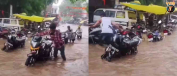
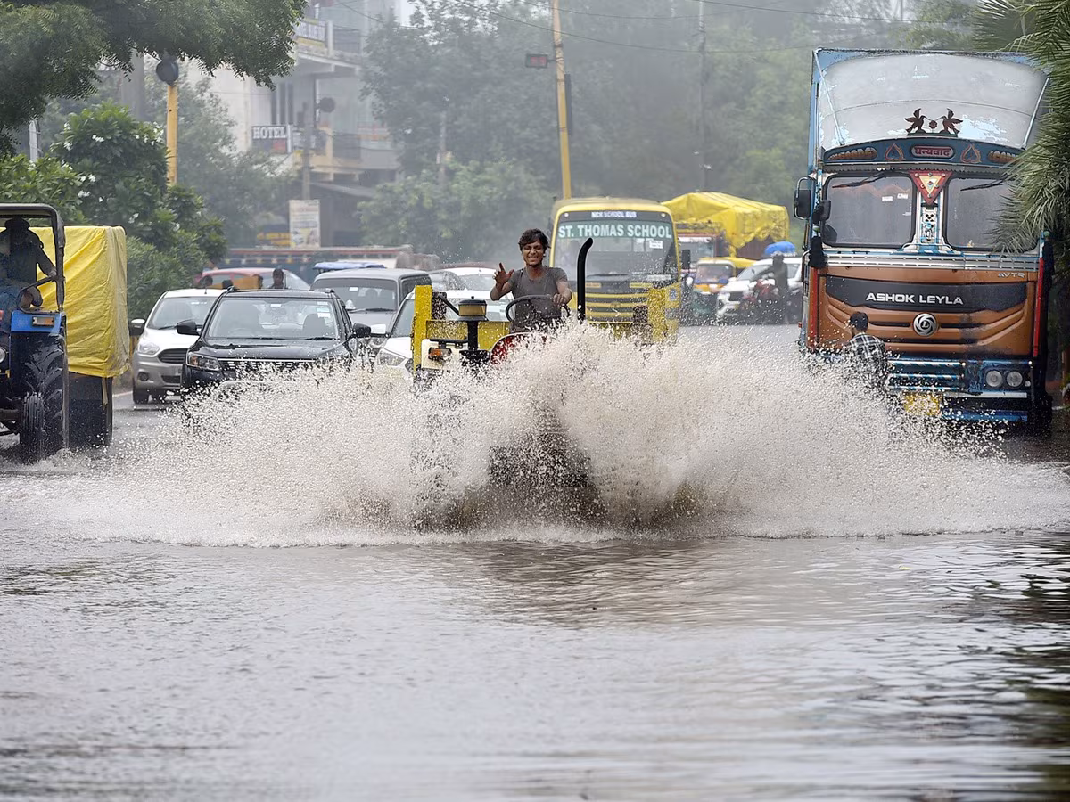
Visuals from Kings Circle, Dadar, Vashi, Andheri, and Chembur showed roads submerged under knee-deep water, severely disrupting traffic.
The IMD attributed this surge in rainfall to a low-pressure system over the Bay of Bengal, coupled with a trough extending towards the Arabian Sea. Officials also warned of “intense to very intense convection” over Mumbai and adjoining districts, raising the risk of further landslides and flash floods.
Upated nowcasts mainly for the States of Maharashtra and Gujarat in orange to red for moderate to intense spells during next 3 hours(Till 1100 hrs IST of 16 August). @ndmaindia @moesgoi @airnewsalerts @DDNewslive pic.twitter.com/t4lwRbK2LA— India Meteorological Department (@Indiametdept) August 16, 2025
Telangana & Hyderabad: Red Alert for Heavy Showers
Telangana is also in the grip of heavy rainfall, with the Hyderabad Meteorological Centre issuing a red alert across multiple districts including Sangareddy, Medak, Khammam, Bhadradri Kothagudem, Bhupalpally, and Mulugu.
-
Hyderabad city has already witnessed severe waterlogging, with Balapur in Ranga Reddy district recording 89 mm rainfall—the highest in the state.
-
The Greater Hyderabad Municipal Corporation (GHMC) has activated emergency control rooms and urged residents, especially in flood-prone zones, to stay indoors.
-
Helpline numbers have been released for public assistance as authorities brace for more downpours.
Rainfall information over mumbai from 0830 hrs IST of 15th August to 0530 hrs IST of 16th August 2025
Vikhroli 248.5 mm
Santacruz 232.5 mm
Sion 221.0 mm
Juhu 208.0mm
Bandra 173.0 mm
Byculla 158.5 mm
Tata Power Chembur 127.5 mm
Colaba 70.4 mm@moesgoi @ndmaindia @airnewsalerts…— India Meteorological Department (@Indiametdept) August 16, 2025
Gujarat, Konkan, and Coastal States
The IMD has issued red and orange alerts for Gujarat and Maharashtra, warning of very heavy rainfall across Konkan, Goa, and Saurashtra-Kutch regions between August 17–18. Marathwada, Vidarbha, and coastal Karnataka are also forecast to receive intense rain spells in the coming week.
Kerala and Andhra Pradesh are expected to witness heavy showers between August 17–18, while Telangana’s red alert remains active for seven days.
VIDEO | Mumbai: Local trains on the Harbour Line are running late due to waterlogging on the railway tracks between Tilaknagar and Kurla stations after the city witnessed heavy rainfall.#MumbaiRains pic.twitter.com/2FiDsXFUCV— Press Trust of India (@PTI_News) August 16, 2025
Delhi & NCR: Red Alert, Yamuna Nears Danger Mark
The national capital has not been spared. After heavy morning showers on Thursday, the IMD escalated Delhi’s alert from yellow to red.
-
Rainfall has already caused traffic snarls, flight delays, and severe waterlogging across Delhi, Noida, and Gurugram.
-
The Yamuna river is inching dangerously close to the danger mark of 205.33 meters, with water levels recorded at 205.26 meters on Saturday. Authorities are on alert, as 50,273 cusecs of water are being released from Okhla and 45,620 cusecs from Wazirabad, while discharges from Hathnikund Barrage continue.
-
If levels cross 206 meters, evacuation from low-lying areas will be initiated.
Meanwhile, Delhi’s Air Quality Index (AQI) stood at 112 (satisfactory range) on Saturday morning, though humidity levels at 90% created muggy and uncomfortable conditions.
#WATCH Mumbai: Heavy rain causes waterlogging in many parts of the city.
Visuals from Kings Circle. pic.twitter.com/X6pQGfgxhq— ANI (@ANI) August 16, 2025
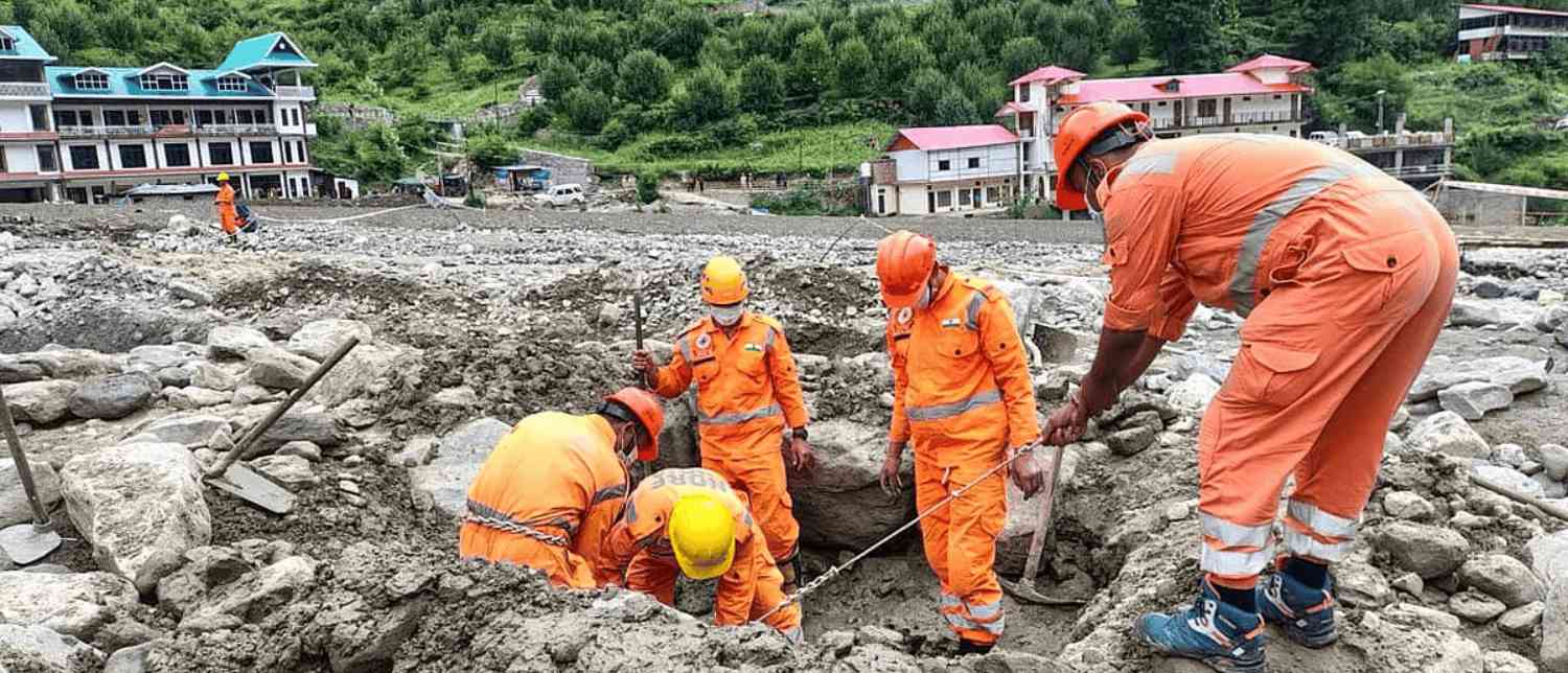
Himalayan States: Landslide Risk & School Closures
Uttarakhand and Himachal Pradesh remain on high alert as the IMD warns of extremely heavy rainfall in Dehradun, Haridwar, Tehri, Nainital, Bageshwar, and Champawat.
-
Continuous rainfall has caused rivers to swell and triggered multiple landslides, blocking roads and isolating villages.
-
Schools and Anganwadi centers in several districts have been shut as a precaution.
-
Himachal Pradesh, Punjab, Haryana, and Jammu & Kashmir are also under heavy rainfall warnings, with winds up to 40 kmph expected.
WR's Monsoon Update @09.30 hrs on 16th August, 2025.#WRUpdates #MumbaiLocals #MumbaiRains #MonsoonUpdates pic.twitter.com/tV7NW9jH4m— Western Railway (@WesternRly) August 16, 2025
Uttar Pradesh & North India
In Uttar Pradesh, the IMD has issued orange alerts for Bareilly, Lakhimpur, Pilibhit, Shahjahanpur, Bahraich, and Gonda, warning of thunderstorms and heavy showers till August 15.
Rainfall is also expected across Rajasthan, Punjab, Haryana, and Jammu & Kashmir until August 20, with risks of flooding and crop damage.
Travel Advisory
Plan ahead, #Mumbai travellers!
The rain’s made an entrance, and so have a few roadblocks around #Mumbai. If you’re travelling today, give yourself a bit of a buffer on the roads.
✅ Please check your flight status via our website or app before leaving home.…— IndiGo (@IndiGo6E) August 15, 2025
Public Advisory & Safety Measures
Authorities across states have issued a strict advisory for citizens:
-
Avoid unnecessary travel, especially through flood-prone and low-lying areas.
-
Stay away from swollen rivers and unstable hillsides vulnerable to landslides.
-
Follow real-time weather updates from the IMD and local authorities.
-
Keep emergency helpline numbers handy.
With monsoon activity forecast to remain intense until August 20, experts warn that the risk of flooding, landslides, and infrastructure damage will remain high in multiple states.
With inputs from agencies
Image Source: Multiple agencies
© Copyright 2025. All Rights Reserved. Powered by Vygr Media.