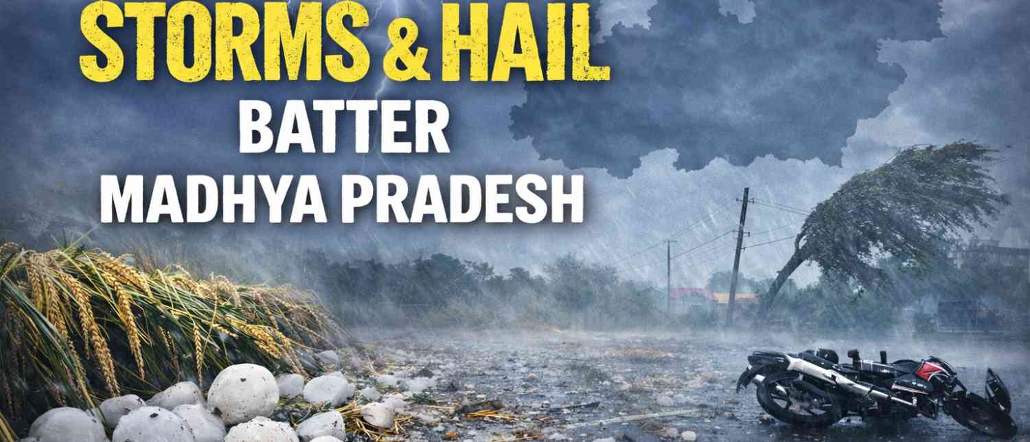

A volatile mix of cyclonic circulations, trough lines, and shifting wind patterns has plunged Madhya Pradesh into a spell of erratic and often violent weather, leaving districts reeling under hailstorms, lightning strikes, and gusty winds—with no immediate relief in sight until at least April 7.
Across the state, the past several days have unfolded like a slow-building crisis. What began as a seasonal transition has escalated into a widespread meteorological disturbance affecting as many as 45 districts simultaneously. The India Meteorological Department (IMD) has issued sweeping alerts warning of thunderstorms, rain, lightning, and hail, particularly across the Mahakaushal and Bundelkhand regions—placing districts like Jabalpur, Katni, and Chhatarpur in the direct line of impact.

A State Under Siege by Multiple Weather Systems
Meteorologists attribute the turmoil to an unusual convergence of weather systems. Two active cyclonic circulations—one over the western part and another over the northern region of the state—are interacting with multiple trough lines cutting across Madhya Pradesh. This layered atmospheric instability has created ideal conditions for thunderstorms, hail, and sudden shifts in temperature and wind patterns.
The impact is being felt unevenly but persistently. On any given day, weather conditions are changing dramatically in 30 to 35 districts, with some witnessing intense winds while others are battered by continuous rainfall or hailstorms.
Wind speeds have surged between 30 to 60 km/h in several regions, amplifying the intensity of storms and increasing the risk of damage to crops, infrastructure, and life.
Lightning Turns Deadly
Amid the chaos, tragedy has already struck. In Seoni district’s Dundasivni block, a lightning strike claimed the lives of a six-year-old boy, Pranshu Markam, and an adult man, Ramzan Khan, in Banjari village on Friday night.
The incident underscores the growing threat posed by lightning during such turbulent weather phases. The strikes occurred during intense storm activity, highlighting how quickly conditions can turn fatal, especially in rural areas where people are more exposed.
#WATCH | Hailstorm, rain showers, and strong winds lash Gwalior city in Madhya Pradesh. IMD has issued a yellow alert in the city, forecasting "thunderstorm accompanied by lightning." pic.twitter.com/bgQehpUOgL— ANI (@ANI) April 4, 2026
Districts on High Alert
The IMD’s alert spans a vast geography. A hailstorm warning has been specifically issued for Jabalpur, Katni, Chhatarpur, Panna, and Damoh—regions already witnessing unstable weather patterns.
Simultaneously, thunderstorms accompanied by lightning and rain are expected across a sweeping list of districts, including Bhopal, Gwalior, Morena, Bhind, Datia, Shivpuri, Guna, Neemuch, Mandsaur, Sehore, Harda, Betul, Raisen, Sagar, Chhindwara, Seoni, Mandla, Dindori, Rewa, and Satna, among others.
Authorities have categorized alerts into yellow and orange levels depending on severity. Yellow alerts—indicating potentially dangerous weather—have been issued in districts prone to hailstorms, while orange alerts warn of more intense thunderstorms, lightning, and gusty winds across central and northern parts of the state.
Ground Reality: Rain, Disruption, and Crop Damage
On the ground, the impact is already visible. Rain and strong winds lashed Satna early Saturday, accompanied by thunder and lightning. Maihar reported rainfall significant enough to disrupt daily routines, while Narmadapuram added to the region’s unsettled conditions with steady drizzle.
In Raisen, wheat crops along the Rampur Maniakheri Road suffered damage as storms swept through overnight. For farmers, this is not an isolated setback but part of a pattern of repeated losses. Hail and rain in the latter half of March had already damaged crops like wheat, papaya, and banana across dozens of districts, leaving the agricultural community particularly vulnerable.
The cumulative effect of these back-to-back weather events is now raising concerns about food security and rural livelihoods, especially as harvest season approaches.
A Relentless Pattern With No Immediate Relief
Forecasts offer little comfort. The current system is expected to remain active for at least the next four days, sustaining the cycle of rain, thunderstorms, lightning, and hail across the state until April 7.
Even beyond that, meteorologists warn of another western disturbance likely to become active around April 7, potentially extending the spell of unstable weather until April 10.
This means Madhya Pradesh could be facing nearly two weeks of continuous weather volatility—an unusually prolonged period for such conditions.
The Inevitable Turn to Heat
Ironically, this turbulent phase is expected to give way to an entirely different extreme. Once the current systems dissipate, temperatures are forecast to rise sharply across the state.
From the second week of April, intense heat is likely to set in, with maximum temperatures in districts such as Gwalior, Dhar, Khargone, Barwani, and Nowgong-Khajuraho projected to reach 44–45°C by the end of the month.
Hot winds in southern and western Madhya Pradesh could further intensify the heatwave conditions, creating a stark contrast to the current stormy weather.
A Climate of Extremes
The unfolding situation highlights a broader pattern of increasing weather volatility in central India. Within days, regions are swinging from heat to hailstorms, from dry spells to lightning-triggering storms.
Meteorologists point to the interaction of moisture-laden winds from both the Arabian Sea and the Bay of Bengal with upper-air disturbances as a key driver of such erratic behavior.
For residents, especially in rural and agricultural belts, the unpredictability has become the most dangerous element. Storms are arriving with little warning, intensifying rapidly, and leaving behind damage that compounds over time.
The Days Ahead
As Madhya Pradesh braces for more storms, the immediate focus remains on safety and damage control. Authorities are urging residents to remain indoors during lightning activity, farmers to secure crops where possible, and local administrations to stay on alert for emergencies.
But with multiple weather systems still active and another disturbance looming, the state’s battle with turbulent skies is far from over.
For now, the forecast is clear in only one sense: uncertainty will continue to define the days ahead.
With inputs from agencies
Image Source: Multiple agencies
© Copyright 2025. All Rights Reserved. Powered by Vygr Media.