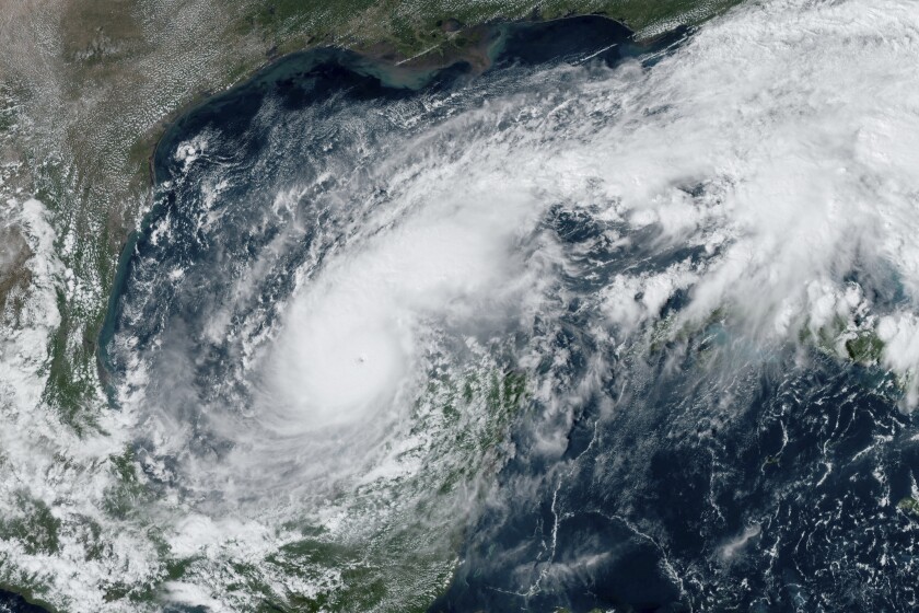
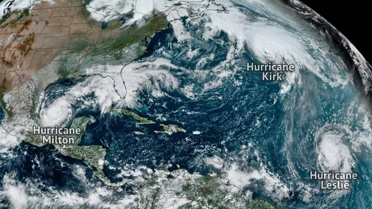
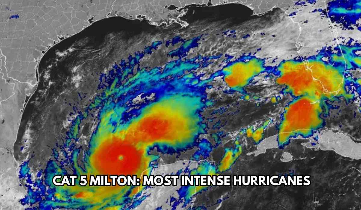
Hurricane Milton has transformed dramatically in less than a day from a weak hurricane to a category 5 storm that will menace Florida while sailing across the Gulf of Mexico. On October 7, 2024, its steady wind stood at 180 miles per hour and pressure considerably lowered, ranking among the most powerful ever to have formed in the Atlantic's history.
Just after few weeks since the devastating impact of Hurricane Helene, the state of Florida is set to take the brunt of Hurricane Milton, which will be landing as a major hurricane on October 9. Rapid intensification of Milton has already forced its residents into a whirlwind flight to be evacuated ahead of this threat.
The National Weather Service defines rapid intensification as an increase of at least 30 knots (about 35 mph) in the maximum sustained wind speed in a tropical cyclone within a 24-hour period. Milton saw its wind speed jump from 80 mph to 175 mph between 1 PM on October 6 and 1 PM on October 7, with its pressure dropping from 988 millibars to 911 during that same interval.

Historical Background of Rapid Intensification

The National Hurricane Centre had issued warnings the prior day that Milton had the potential to become a major hurricane. It is often not such a surprise for communities, especially near landfall, when storms suddenly undergo such rapid changes. The past storms, Hurricane Michael in 2018 and Hurricane Otis in 2023, made those similarities, so greater awareness prevails.
Forecasting rapid intensification is pretty challenging, but some critical factors play into the phenomenon:
- Oceanic Heat: The vital energy for hurricanes to become stronger is derived from the warm sea surface temperatures. In the Gulf of Mexico where Milton sits currently, sea surface temperatures reached about 30 degrees Celsius or 86 degrees Fahrenheit.
- Low Wind : Favorable atmospheric conditions, such as low vertical wind shear, allow hurricanes to develop more rapidly as they have fewer disruptions to their organization.
- Moisture Availability: The warmer it is, the lower the salinity, and therefore the greater the moisture content, the greater will be the growth of a storm. This will enhance the intensity of the storm through the warm waters as well as moisture.
- Thunderstorm Activity: Internally broken up by intense thunderstorms that sometimes develop within the rotation of the storm, the circulation patterns are reorganized even when not that ideal.
US Government 'Ready to Respond'
As Hurricane Milton heads towards Florida, the White House has assured the public that the US government is prepared to respond to any potential impacts. President Joe Biden has approved Florida Governor Ron DeSantis' request for an emergency declaration, allowing the Federal Emergency Management Agency (FEMA) to provide immediate support.
The White House has urged residents to remain vigilant and follow the guidance of local officials.
Hurricane Milton Weakens to Category 4 on Path to Florida
Hurricane Milton has weakened to a Category 4 storm as it heads toward Florida, according to the National Hurricane Center in Miami. Today morning it is reported that, the hurricane had maximum sustained winds of approximately 155 mph and was located 85 miles northeast of Progreso, Mexico. The storm is currently moving east-northeast at 12 mph and is about 560 miles southwest of Tampa.
Role of Climate Change
_1728376719.jpg)
There is evidence that rapid intensification of tropical cyclones is linked with climate change. Present research has established a general trend of increasing rapid intensification of tropical cyclones, especially over the past four decades. Scientific estimates suggest that human-induced climate change appears to be driving the trend of major hurricanes. While the ocean's temperature and atmospheric circumstances alter with climate change, there is a higher potential for such hurricanes like Milton to occur more frequently and intensify. Thus, already, research and interest in the relationship of climate change with the behavior of hurricanes are interested in topics on how they are related.
With inputs from agencies
Image Source: Multiple agencies
© Copyright 2024. All Rights Reserved Powered by Vygr Media.


