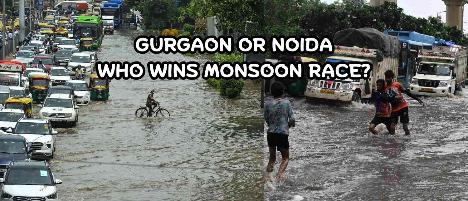

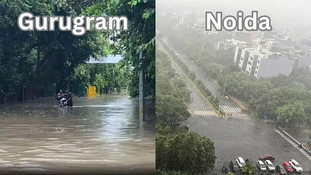
Every monsoon, the National Capital Region (NCR) of India reveals a striking contrast. Gurgaon, the so-called “Millennium City,” grinds to a halt after even moderate rainfall. Noida, its neighbouring city across the Yamuna, continues moving with far fewer disruptions.
The disparity is not a matter of luck. Both cities face similar rainfall intensity—on some days, 100 mm or more. Yet while Gurgaon drowns in knee-deep water, massive traffic snarls, and flooded homes, Noida’s roads largely remain functional.
The difference lies in the DNA of urban planning, infrastructure investment, drainage networks, and governance. Together, these hidden factors explain why Gurgaon floods while Noida moves.
Gurgaon: A Case Study in Unplanned Urbanisation
1. Development Driven by Private Builders
Gurgaon’s modern rise has been rapid, but uneven. Its growth was spearheaded by large private developers like DLF under a Public-Private Partnership (PPP) model. The Haryana government built some external infrastructure, but the internal systems, roads, drains, and sewers were fragmented and often disconnected.
Unlike a unified master plan, Gurgaon’s infrastructure evolved in silos. Reports note that since the 1970s, Haryana’s land acquisition policies have allowed private players to acquire scattered parcels, creating irregular layouts and roads that often end abruptly. This patchwork approach left no room for a comprehensive drainage or road network.
2. Natural Drainage Blocked
Gurgaon lies on the edge of the Aravalli ridge, with natural slopes leading rainwater toward the Najafgarh Jheel. Historically, rainfall drained smoothly through channels, wetlands, and ponds. But urban sprawl has choked these natural outlets.
Traditional water bodies like Ghata Jheel, Badshahpur Jheel, and Khandsa Talab have been encroached upon or filled up for construction. With natural drainage gone, rainwater now stagnates on roads and low-lying areas, flooding residential colonies and arterial highways.
3. Poor Drainage and Limited Coverage
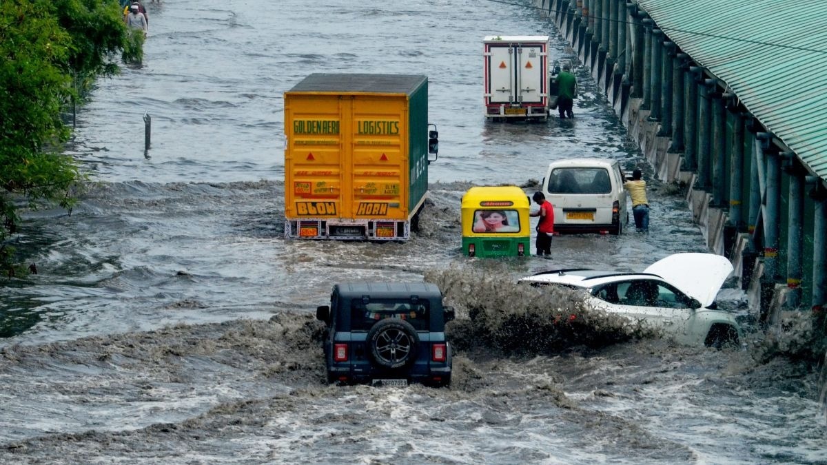
The numbers tell their own story. Gurugram, serving a comparable population to Noida, has less than 40 km of stormwater drains, many clogged or poorly maintained. When 100 mm of rain falls in a few hours, these drains collapse under pressure.
On key stretches like MG Road, Sohna Road, and the Delhi–Jaipur Expressway, waterlogging can immobilise commuters for hours, sometimes six or more. Viral videos of endless traffic snarls are a recurring monsoon ritual.
4. Traffic Chaos and Road Network Gaps
Unlike cities built with a grid network, Gurgaon’s roads are patchy and uncoordinated. Bottlenecks worsen during flooding as water accumulates in underpasses and poorly graded lanes. The narrow stretches in older sectors cannot cope with modern traffic volumes, let alone floodwater.
5. Governance: Reactive, Not Proactive
Gurgaon only got a municipal corporation in 2007 and a dedicated development authority in 2017, decades after its explosive growth. By then, private-led urbanisation had already cemented structural flaws.
Civic authorities typically respond reactively—deploying pumps, diverting traffic, or declaring emergencies—once flooding occurs. Long-term investments in sustainable drainage, rainwater harvesting, or flood modelling remain limited.
Noida: A Model of Planned Development
1. A Greenfield City With a Master Plan
In contrast, Noida was born as a planned city in 1975, under the New Okhla Industrial Development Authority (NOIDA). Established during the Emergency, it was designed as a greenfield industrial township under the Uttar Pradesh Industrial Area Development Act, 1976.
Unlike Gurgaon’s fragmented growth, Noida’s land—nearly 15,000 hectares across 50 villages initially, later expanded to 20,316 hectares over 81 villages—was acquired in bulk. Infrastructure came first: roads, drains, sewers, streetlights, footpaths, all laid out before private construction began.
This ensured that every new development plugged into a common backbone of infrastructure, not isolated patches.
2. Robust Drainage Infrastructure
Noida’s resilience rests on its 87 km stormwater drainage network—more than double Gurgaon’s. These well-designed culverts and retention ponds channel rainwater away quickly, minimising road flooding.
The city also benefits from being situated on the Yamuna floodplain, with loamy soil that absorbs water naturally. By preserving natural channels, Noida has avoided the chronic waterlogging Gurgaon suffers from.
3. Integration of Green Belts and Open Spaces
Planners in Noida emphasised green belts, wetlands, and open parks. These act as natural sponges, soaking up rainwater and reducing runoff. Rainwater harvesting systems and ventilated drains further prevent clogging and health hazards.
In Gurgaon, by contrast, concrete sprawl has erased green cover, leaving little room for absorption.
4. Governance and Expert Partnerships
Noida’s civic governance has been comparatively proactive. The Noida Authority has worked with IIT Roorkee to redesign its drainage systems and address chronic flooding points. Smart city tools are deployed to monitor rainfall patterns and flood risks.
By contrast, Gurgaon’s governance has largely lagged—investing in fixes only after chaos erupts.
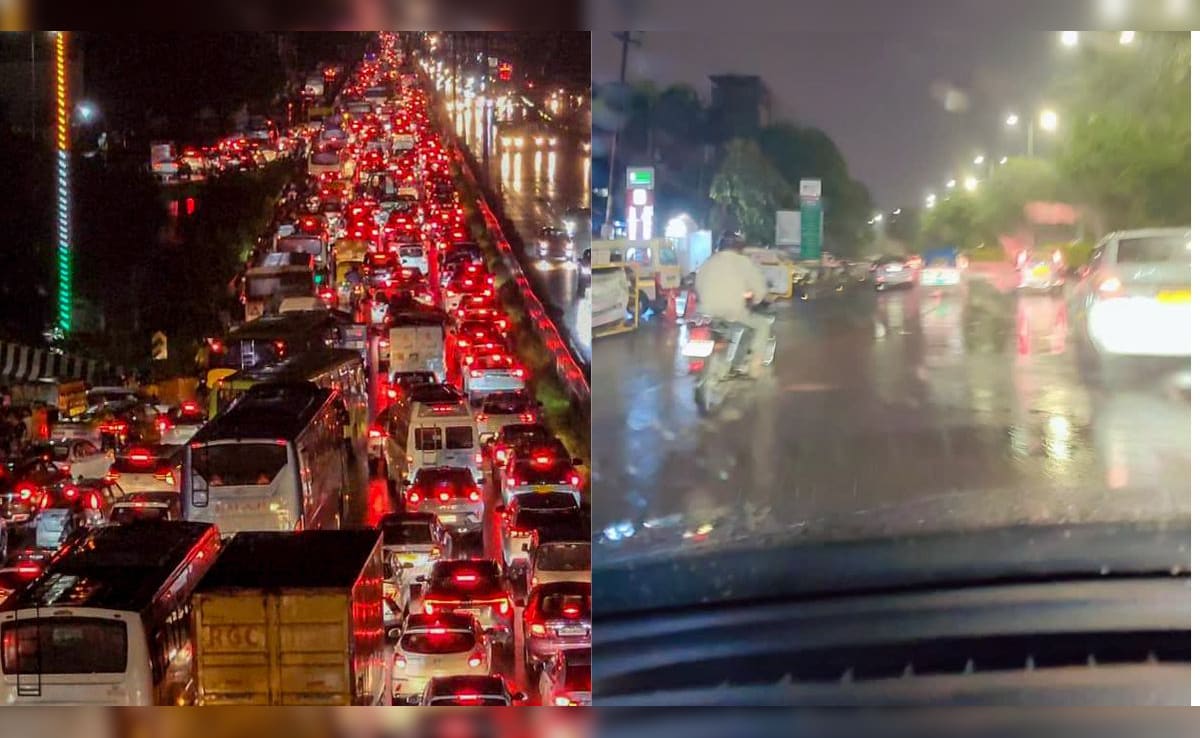
5. Roads, Metro, and Mobility Advantage
Noida’s wide, well-maintained roads and Delhi Metro connectivity ensure mobility even during heavy showers. Traffic management systems allow quick diversions when routes clog.
Gurgaon, heavily reliant on private cars, suffers worse when roads flood. Public transport is sparse, amplifying gridlock during monsoon breakdowns.
-1744989607678_1756981125.webp)
The Social Media Verdict: Noida Wins the Rain Game
Every heavy downpour fuels the Noida vs Gurgaon rivalry online. Viral videos of waterlogged Gurgaon expressways compared to dry Noida boulevards spark memes, reels, and heated debates.
On Instagram, one reel went viral with the caption: “Rainy bliss in Noida, traffic stress in Gurgaon – the choice is clear. Habibi, come to Noida.”
On X (formerly Twitter), commuters echoed similar sentiments:
-
“Noida roads are way more organised than Gurgaon, and way cleaner,” wrote one user after driving 120 km through NCR rains.
-
“In the Noida vs Gurgaon debate, the only clear win for Noida has always been infrastructure,” another remarked.
-
“Noida was planned, Gurgaon just grew,” wrote another user.
While Noida has its occasional flooding hotspots, the public perception remains firmly in its favour: Gurgaon drowns, Noida moves.

Climate Change and the Road Ahead: Can Gurgaon Catch Up?
The contrast between Gurgaon and Noida is more than just an NCR rivalry — it’s a cautionary tale about urbanisation in India. With climate change projected to increase the frequency of intense rainfall events, both cities face mounting pressure.
-
For Gurgaon: Gurgaon’s challenges stem from fragmented growth, disappearing water bodies, poor drainage, and short-sighted governance. Addressing them requires systemic re-engineering: reviving encroached wetlands, restoring natural drainage channels, and expanding infrastructure in line with the city’s rapid growth. Equally vital are bold investments in integrated stormwater management and stronger, accountable governance rooted in sustainable urban planning. Without such measures, the “Millennium City” risks being overwhelmed by its own unchecked ambitions.
-
For Noida: Success today doesn’t guarantee resilience tomorrow. As the city expands, it must continue upgrading infrastructure, preserving green spaces, and future-proofing drainage systems. Maintaining its relative edge requires vigilance, not complacency.
Noida, while better placed, cannot afford complacency. With rapid expansion and rising population pressure, it too must upgrade its infrastructure continuously, preserve green spaces, and adapt to climate change-driven extreme rainfall events.
Two Cities, Two Futures
The monsoon doesn’t discriminate, but urban planning does. Gurgaon’s flooded streets and Noida’s functional roads are not accidents of geography but outcomes of decades of choices in governance, infrastructure, and design.
One city is a global corporate hub hobbled by short-sighted planning; the other, a planned township that has emerged as a model of resilience. Together, they highlight the urgent need for sustainable, integrated urban planning across India’s rapidly growing cities.
Because when the next cloudburst hits NCR, the question will remain the same: Will your city sink, or will it stay standing?
With inputs from agencies
Image Source: Multiple agencies
© Copyright 2025. All Rights Reserved. Powered by Vygr Media.